 Safekipedia
Magallanes Region
Adapted from Wikipedia · Adventurer experience
The Magallanes Region, officially called the Magallanes y la Antártica Chilena Region, is one of the 16 main parts of Chile. It is the southernmost, largest, and one of the least crowded areas in the country. The region is made up of four smaller parts called provinces: Última Esperanza, Magallanes, Tierra del Fuego, and Antártica Chilena. It is named after the Strait of Magellan, a narrow waterway that runs through it. This strait was named after Ferdinand Magellan, a leader of an early European exploration group that found the strait.
The Magallanes Region has some amazing natural places, like Torres del Paine, Cape Horn, Tierra del Fuego island, and the Strait of Magellan. It also includes a part of Antarctica that Chile claims. Even though the region is very big, much of the land is rough or used for sheep farming, making it hard for many people to live there. About 80% of the people in the region live in its capital city, Punta Arenas, which is an important market city and a key place for trips to Antarctica.
The main ways people make money in Magallanes are through sheep farming, getting oil from the ground, and welcoming tourists. Since 2017, the region has its own special time zone, and it uses summer time all year long, which means it is always UTC−3.
Geography
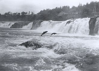
The Magallanes Region has tall mountains and glaciers, especially in the north, including parts of the Patagonian Ice Sheet. Further south, there are more mountains and many bodies of water like the Seno Última Esperanza, Eberhard Fjord, and Lago Grey. Important protected areas are Torres del Paine National Park and the Cueva del Milodon Natural Monument, where scientists found remains of large extinct animals and very old human artifacts.
The land here can be split into four main areas: islands to the west and south, a mountainous area in the west and south, a flat area in the northeast, and a zone between the mountains and the flat lands.
Climate
The Magallanes Region has cool temperatures and strong winds all year. It has five different climate types because of its varied heights and wide span. Because it is close to 60°S latitude, where low pressure systems often occur, weather patterns change frequently here.
The farthest western islands have a cold, wet climate with lots of rain and strong winds. These islands receive about 3,500 mm of rain each year, and temperatures stay around 9°C. Moving east, the climate becomes drier because the Andes mountains block much of the rain. In these areas, yearly rain is between 250 and 400 mm, and temperatures are about 6-7°C.
In the eastern parts, including much of Tierra del Fuego province, the climate is cold and dry. Rain here is between 250 and 500 mm a year, with temperatures ranging from 8-9°C.
Higher up, near the Southern Patagonian Ice Field, it is cold enough for permanent ice. Temperatures stay below 0°C all year, with lots of snow.
The southernmost islands have a tundra climate, with cool temperatures year-round and lots of rain, usually around 1,000 mm a year.
History
The Magallanes Region began in 1878 as the Territory of Magallanes. It grew and reached its largest size that year, with its northern border at the Santa Cruz River and its eastern border at the Atlantic Ocean. In 1928, it became the Province of Magallanes. This province lasted until 1974, when it became the Magallanes Region. Its final borders were set after treaties in 1881 and 1902.
Political and administrative divisions
The Magallanes and Chilean Antarctica Region has its capital in the city of Punta Arenas. It is divided into four provinces for government and administration. These are:
- Chilean Antarctic Province, with its capital at Puerto Williams
- Magallanes Province, with its capital at Punta Arenas
- Tierra del Fuego Province, with its capital at Porvenir
- Última Esperanza Province, with its capital at Puerto Natales
These provinces are split into 11 smaller areas called municipalities.
| Province | Commune | Area (km2) | Population 2002 Census | Population 2012 Census | Commune website |
|---|---|---|---|---|---|
| Antártica Chilena | Antártica | 1,250,000 | 130 | 115 | link |
| Antártica Chilena | Cabo de Hornos | 15,854 | 2,262 | 1,677 | link |
| Magallanes | San Gregorio | 6,884 | 1,158 | 384 | link |
| Magallanes | Río Verde | 9,975 | 358 | 153 | link |
| Magallanes | Punta Arenas | 17,846 | 119,496 | 127,454 | link |
| Magallanes | Laguna Blanca | 3,696 | 663 | 208 | link |
| Tierra del Fuego | Timaukel | 10,996 | 423 | 204 | link |
| Tierra del Fuego | Primavera | 4,614 | 1,016 | 545 | link |
| Tierra del Fuego | Porvenir | 6,983 | 5,465 | 5,907 | link |
| Última Esperanza | Torres del Paine | 6,470 | 739 | 180 | link |
| Última Esperanza | Natales | 48,974 | 19,116 | 18,505 | link |
Demographics
The Magallanes Region has a small population, one of the smallest in Chile. It was one of the last areas of Chile where people settled. In the mid-1800s, only a few hundred people lived there, mostly in the town of Punta Arenas.
More people moved to the region over time. Many came from Europe, like Croatia, Britain, Switzerland, and Italy. Others came from southern Chile, especially the Chiloé Archipelago. Today, Punta Arenas has many people whose families came from Europe, especially from Croatia and Britain.
The population has grown slowly in the last 50 years, but the region still has fewer people than other parts of Chile. Most people live in towns such as Punta Arenas, Puerto Natales, Porvenir, and Puerto Williams, which is one of the southernmost cities in the world.
Census
- 1952: 55,206 hab.
- 1960: 73,358 hab.
- 1970: 89,443 hab.
- 1982: 131,914 hab.
- 1992: 143,198 hab.
- 2002: 150,826 hab.
- 2017: 165,593 hab.
- 2024: 166,537 hab.
Economy
The Magallanes Region has a strong economy even though not many people live there. In 2024, its economy grew about 5.6%, faster than the rest of Chile. This growth came from making things, building, fishing, and more tourists visiting.
The area is famous for raising sheep and cattle. It has over three million sheep, which is more than half of all the sheep in Chile. These animals help make meat, wool, and other products sold around the world. The region also gets resources from oil, natural gas, and coal. Fishing is very important, with salmon, trout, and crab being major exports. Making ethanol is also a big part of the economy. Tourism is growing fast because of the beautiful glaciers, forests, and mountains, including famous places like Torres del Paine National Park. Many visitors come to see these natural wonders, which helps the local economy.
Education
The University of Magellan is in Punta Arenas, a city in southern Chile. It opened in 1981 and has campuses in Punta Arenas and Puerto Natales, plus a small center in Puerto Williams. The university puts out a journal named Magallania twice a year.
Images
Related articles


This article is a child-friendly adaptation of the Wikipedia article on Magallanes Region, available under CC BY-SA 4.0.
Images from Wikimedia Commons. Tap any image to view credits and license.