
Carnac stones
The Carnac stones (Breton: Steudadoù Karnag) are a huge group of very old stone structures close to the southern coast of Brittany in northwestern France. These include rows of stones, stone tombs, burial mounds, and single tall stones called menhirs. More than 3,000 of these ancient standing stones were cut from local granite and put up by people who lived long ago, before the Celtic people arrived. Most of these stones are found in the town of Carnac, with some in nearby La Trinité-sur-Mer. Many more stone structures can be found in surrounding areas such as Locmariaquer, Arzon, and on islands in the Gulf of Morbihan, like Gavrinis.
These stones were put up during the Neolithic period, probably around 3300 BC, with some possibly dating back to as early as 4500 BC. Even though they are very old, people in later times thought the stones had special meanings. One story says that they were soldiers turned to stone by Pope Cornelius. Another local tale says they were a Roman legion turned to stone by Merlin the Wizard.
Over the past few hundred years, many of these stone sites were not taken care of well. Some were even used as shelters for animals or for making things. Often, stones were taken away to build roads or houses. How to best care for these important places is still a subject of discussion. Some experts, like Neil Oliver in his BBC documentary A History of Ancient Britain, think these stones were built by hunter-gatherer people, different from the people who built Stonehenge in England. The exact people who made the Carnac stones is still a topic that scholars talk about.
Alignments
There are three main groups of stone rows: Ménec, Kermario, and Kerlescan. They might have once been one big group, but now they are separate because some stones were taken away for other uses. All together, they follow a line about 20 meters above sea level.
The stones are made from granite that was found nearby and used to build these amazing rows.
Ménec alignments
The Ménec alignments have eleven rows of tall standing stones that stretch for 1,165 by 100 metres (3,822 by 328 feet). Some experts think there used to be stone circles at both ends. At the western end, there is a group of 71 stone blocks, and at the eastern end, there are more stones, though they are very broken. The biggest stones, about 4 metres (13 feet) high, are at the western end. The stones get smaller as you move along the rows, and then they get bigger again toward the very eastern end.
Kermario alignment
A little farther to the east is the Kermario alignment, also called the "House of the Dead." It has 1,029 stones arranged in ten columns, stretching about 1,300 metres (4,300 feet). Aerial photography showed that there might have been a stone circle at the eastern end where the stones are shorter.
Kerlescan alignments
Even farther east is the Kerlescan alignment, a smaller group with 555 stones. These stones form 13 lines that are about 800 metres (2,600 feet) long. The stones range in height from 80 centimetres (2 feet 7 inches) to 4 metres (13 feet). At the western end, where the stones are tallest, there is a stone circle with 39 stones. There might also be another stone circle to the north.
Petit-Ménec alignments
The Petit-Ménec alignments are the smallest group, located even farther east in the area of La Trinité-sur-Mer. These stones are now growing in woods and are covered with moss and ivy.
Gallery
Model of the _Kermario_ alignment
Model of the _Kerlescan_ alignment
Tumuli
There are several tumuli, which are mounds of earth built over graves. In this area, they usually have a passage leading to a central chamber that once held special objects from long ago.
Three very large burial mounds from the Carnac and Morbihan area are known as the 'Carnacéen tumuli'. They date back to around 4500 BC and include Saint-Michel, Tumiac, and Mané-er-Hroëk. Each of these tumuli had a special stone chamber inside, containing important objects like axes, jewellery, and beads made from special stones like jade and callaïs. Some of these objects came from far away, showing that people in that time could travel and trade over long distances. The size and richness of these burial mounds suggest they were for very important people.
Saint-Michel
Main article: Saint-Michel tumulus
The tumulus of Saint-Michel was built between 5000 BCE and 3400 BCE. It is very large, measuring 125 by 60 metres at its base and 12 metres high. It was made using 35,000 cubic metres of stone and earth. It served as a tomb for important members of society. Inside, archaeologists found many special objects, such as stone chests, large jade axes, pottery, and callaïs jewellery, which are now kept in the Museum of Prehistory of Carnac. The tumulus was first explored in 1862 and again between 1900 and 1907.
Tumiac
Main article: fr:Tumulus de Tumiac
The tumulus of Tumiac is located in Arzon, in the Rhuys peninsula. It is sometimes called 'Caesar's mound' because of a local legend. The tumulus is circular and measures 50 metres in diameter and 15 metres in height. Inside, there is a stone chamber that contained many valuable objects like jadeite axes and beads, which are now kept in the Archaeological Museum of Vannes.
Mané-er-Hroëk
Main article: fr:Tumulus du Ruyk
The Tumulus of Mané-er-Hroëk is located in Locmariaquer, Morbihan. It has a stone vault covered by a large mound. Inside, archaeologists found many precious stone axes and beads, which are now kept in the Archaeological Museum of Vannes.
Moustoir
47°36′43″N 3°03′39″W / 47.6119°N 3.0608°W / 47.6119; -3.0608 Also known as Er Mané, it is a chamber tomb. It has a dolmen at one end and two tombs at the other end, with a nearby menhir.
Grave goods
The grave goods found near the Carnac stones include special stones called Callaïs from places like Saint-Michel and Tumiac. Other items discovered are axes made from jadeitite and stone, along with stone rings and polished axes. These items were found during excavations of the Saint-Michel tumulus, giving us clues about the people who lived there long ago.
Dolmens
There are several dolmens in the area. These dolmens were likely used as tombs, but the soil has worn away any bones that might have been there. They were built with big stones holding up a flat top stone, and were often covered with a pile of dirt. In many places, only the stones are left.
Er-Roc'h-Feutet
North, near the Chapelle de La Madeleine. It has a fully covered roof.
La Madeleine
47°37′15″N 3°02′54″W / 47.6208°N 3.0482°W / 47.6208; -3.0482 This is a large dolmen, about 12 by 5 metres, with a broken top stone that is 5 metres long. It is named after the nearby Chapelle de La Madeleine, which is still standing.
Kercado
Main article: Kercado tumulus
This dolmen is still covered by its original pile of stones. It is south of the Kermario alignments, about 25 to 30 metres wide and 5 metres high, with a small standing stone on top. Inside, many old objects were found, like axes, arrowheads, animal and human teeth, beads, and special blue stones. It was built around 4600 BC and used for about 3,000 years.
Mané Brizil
Kerlescan
This has a roughly rectangular shape, with only one top stone left. It faces east to west, with a doorway on the south side.
Kermarquer
Located on a small hill, it has two separate rooms.
Mané-Kerioned
Also called Pixies' mound or Grotte de Grionnec. This group of three dolmens has a special layout, arranged in a horseshoe. The largest one is at the east end and is 11 metres long.
Crucuno
This is a classic dolmen with a very heavy top stone resting on pillars. Before 1900, it was connected by a long passage.
Crucuno stone rectangle
47°37′30″N 3°07′19″W / 47.625°N 3.122°W / 47.625; -3.122 This is a group of 21 standing stones arranged in a special shape, pointing toward the sunrise on the longest day of the year.
Other formations
There are some special stone structures that do not belong to the main groups. One of these is called the Manio quadrilateral. It is a big rectangle made of stones. It used to have a dirt mound in the middle and is quite long — about 37 meters (121 feet). It is wider on one side than the other.
Near the quadrilateral stands a very tall stone called the Giant. It is more than 6.5 meters (21 feet) high and was put back up around the year 1900 by a man named Zacharie Le Rouzic. The Giant looks out over another group of stones called the Kerlescan alignment.
Excavation and analysis
Starting in the 1720s, people began to take more interest in these amazing stone structures. In 1796, someone thought they might have been used for special gatherings, while another person in 1805 thought the stones looked like stars in the sky.
In 1834, two men from England carefully measured and drew the stones. One of them even used a special tool he invented to make very accurate pictures of the stones.
Miln and Le Rouzic
In the 1860s, a man named James Miln started digging and studying the stones. He found that fewer than 700 of the original 3,000 stones were still standing. Around 1875, he hired a local boy named Zacharie Le Rouzic to help him. Zacharie learned about archaeology by working with Miln. After Miln passed away, Zacharie took over and became a famous expert on these stone structures. He shared everything he found with the town of Carnac, and a museum was built there in his and Miln's honor.
Other theories
In 1887, someone suggested that the stone rows might point toward where the sun sets during special days of the year.
Later, from 1970 to 1974, a father and son team studied the stone lines very carefully. They wrote papers about possible connections between the stones and patterns in the stars and numbers. Some people have also thought the stones might have been used to track the stars, just like another famous stone place called Stonehenge. One big stone near Locmariaquer might have been part of such a system.
Management
The Musée de Préhistoire James Miln – Zacharie le Rouzic plays a key role in protecting and showing artefacts from the area. It holds the world's largest collection of prehistoric exhibits, with over 6,600 objects from 136 different sites.
The stones were listed and bought by the government in the early 1900s to keep them safe. Later, changes in farming, more tourists, and new buildings caused the stones to get damaged. In 1991, the Heritage Ministry started a project called 'Mission Carnac' to help save the stones. This included limiting visits, doing studies, and making plans for the area.
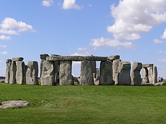
Like Stonehenge in England, managing these stones can be tricky. Fences were put up to protect the stones, and only organised tours can visit some areas during certain times. In the past, some stones were moved to make space for roads.
Recently, letting sheep graze near the stones has been tried to control unwanted plants. In 2023, some stones outside the UNESCO protected area were destroyed to build a store, which caused concern from people who wanted to protect the stones. In 2025, the stones and many other monuments in the area became World Heritage Sites by UNESCO.
Pictures
Keep exploring


This article is a child-friendly adaptation of the Wikipedia article on Carnac stones, available under CC BY-SA 4.0.
Images from Wikimedia Commons. Tap any image to view credits and license.