 Safekipedia
North Island
Adapted from Wikipedia · Discoverer experience
The North Island (co-officially Te Ika-a-Māui from Māori) is one of the two main islands of New Zealand, separated from the larger but less populous South Island by Cook Strait. It covers 113,729 km2 (43,911 sq mi), making it the world's 14th-largest island and home to 43% of New Zealand's land.
With a population of 4,067,400 as of June 2025, the North Island holds 76% of New Zealand's residents. It is the most populous island in Polynesia and ranks as the 28th-most-populous island in the world.
Twelve main cities lie across the North Island, from north to south: Whangārei, Auckland, Hamilton, Tauranga, Rotorua, Gisborne, New Plymouth, Napier, Hastings, Whanganui, Palmerston North, and New Zealand's capital city, Wellington, situated at the island's southwest tip.
Naming and usage
The North Island has been called that in English for many years. It also has an official Māori name, Te Ika-a-Māui, which means "the fish of Māui." This name is not used much by most people. Other old Māori names include Te Ahi no Māui, meaning "the fire of Māui," and Aotearoa, which means "land of the long white cloud" and is often used for all of New Zealand.
In 2013, the New Zealand Geographic Board officially named the island North Island or Te Ika-a-Māui after asking people for their ideas. When talking about the two main islands of New Zealand, we say "the North Island" and "the South Island." We usually say a place is "in the North Island," like "Hamilton is in the North Island." On maps and in headings, we just say "North Island" without "the."
Māori mythology
According to Māori mythology, the North and South Islands of New Zealand were formed through the actions of the demigod Māui. Māui and his brothers were fishing from their canoe, which became the South Island, when Māui caught a huge fish and pulled it from the sea. While he wasn’t watching, his brothers fought over the fish and cut it into pieces. This fish became the North Island, and one Māori name for it is Te Ika-a-Māui, meaning "The Fish of Māui." The mountains and valleys are said to come from Māui’s brothers carving up the fish.
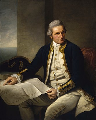
During Captain James Cook’s voyage between 1769 and 1770, a Tahitian navigator named Tupaia helped map New Zealand. He called the North Island names that mean “The Fish of Māui.” Some tribe names, like Muaūpoko and Muriwhenua, also show where they settled on this “fish.” Another old name for the North Island is Aotearoa, but this name is now used for all of New Zealand.
Geography
Main article: Geography of the North Island
The North Island of New Zealand was once connected to the South Island during a time when sea levels were much lower. This happened during the Last Glacial Period. As the seas rose about 7,000 years ago, the two islands separated, creating the Cook Strait.
The island has many interesting places, such as beautiful bays like the Bay of Islands and Bay of Plenty, large lakes like Lake Taupō, and tall mountains like Mount Ruapehu. There are also famous forests and parks, including Tongariro National Park and the Waipoua Kauri Forest.
Demographics
The North Island has an estimated population of 4,067,400 as of June 2025.
The North Island had a population of 3,808,005 at the 2023 New Zealand census, which is an increase of 213,453 people (5.9%) since the 2018 census. Of this total population, 733,893 people (19.3%) were aged under 15 years, 743,154 (19.5%) were 15 to 29, 1,721,427 (45.2%) were 30 to 64, and 609,534 (16.0%) were 65 or older.
The North Island has more people than the South Island. The largest city, Auckland, and the capital, Wellington, make up almost half of the island's population. The area known as the Golden Triangle between Auckland, Hamilton, and Tauranga holds nearly half of New Zealand's people and much of its economic activity.
| Name | Population (June 2025) | % of island |
|---|---|---|
| Auckland | 1,547,200 | 38.0% |
| Wellington | 209,800 | 5.2% |
| Hamilton | 192,100 | 4.7% |
| Tauranga | 160,900 | 4.0% |
| Lower Hutt | 113,200 | 2.8% |
| Palmerston North | 81,200 | 2.0% |
| Napier | 66,400 | 1.6% |
| Porirua | 60,100 | 1.5% |
| Hibiscus Coast | 67,800 | 1.7% |
| New Plymouth | 60,200 | 1.5% |
| Rotorua | 58,500 | 1.4% |
| Whangārei | 56,100 | 1.4% |
| Hastings | 49,800 | 1.2% |
| Upper Hutt | 44,500 | 1.1% |
| Whanganui | 42,800 | 1.1% |
| Gisborne | 38,100 | 0.9% |
| Paraparaumu | 29,900 | 0.7% |
| Pukekohe | 28,800 | 0.7% |
| Taupō | 27,000 | 0.7% |
| Masterton | 22,600 | 0.6% |
| Cambridge | 22,700 | 0.6% |
| Levin | 20,500 | 0.5% |
| Feilding | 17,650 | 0.4% |
| Whakatāne | 16,950 | 0.4% |
| Havelock North | 15,000 | 0.4% |
| Tokoroa | 14,500 | 0.4% |
| Waikanae | 13,600 | 0.3% |
| Te Awamutu | 13,950 | 0.3% |
| Hāwera | 10,700 | 0.3% |
| Te Puke | 10,400 | 0.3% |
Economy
The North Island's part of New Zealand's economy was about NZ$282.355 billion in 2021. This was 78% of all the money made in New Zealand that year.
Transport
Air
Main article: List of airports in New Zealand
The North Island has several important airports. Auckland Airport is the largest and busiest, with many people flying in and out each year. Wellington Airport is also very busy and serves many travelers. There are smaller airports too, like Kerikeri Airport, Gisborne Airport, Hamilton Airport, Hawke's Bay Airport, New Plymouth Airport, Palmerston North Airport, Rotorua Airport, Taupō Airport, and Tauranga Airport.
Governance
The North Island is divided into nine regions, each with its own local government. These regions cover the island and nearby smaller islands and waters. The regions are:
Images
Related articles


This article is a child-friendly adaptation of the Wikipedia article on North Island, available under CC BY-SA 4.0.
Images from Wikimedia Commons. Tap any image to view credits and license.