
Bad Camberg
Bad Camberg is a town in Germany with many people living there. It is in the Limburg-Weilburg district in Hesse. The town is located in the eastern Taunus mountains in an area called the Goldener Grund, or “Golden Ground.” It is not far from big cities like Wiesbaden, Limburg an der Lahn, and Frankfurt. Bad Camberg lies along the German Timber-Frame Road.
Bad Camberg is known for being a special kind of health resort. It is one of the oldest in Germany. In the area of Oberselters, there is a mineral spring that makes famous Selterswasser. The town’s landmark is the Kreuzkapelle.
Geography
Location
Bad Camberg is a town in Germany. It is north of the Taunus mountains. The town is 18 km southeast of Limburg an der Lahn. It is the southernmost town in Middle Hesse. Nearby cities include Wiesbaden (31 km south), Frankfurt am Main (48 km southeast), Wetzlar (49 km), Koblenz (72 km), and Gießen (75 km).
Heights
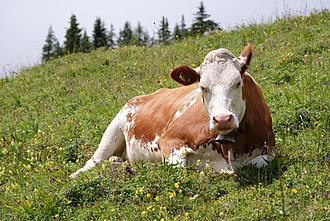
The town sits 209 meters above sea level. The highest point in the Limburg-Weilburg district is called the Kuhbett or “Cow’s Bed.” It is 526 meters high and near Erbach. The highest point in central Bad Camberg is Kapellenhügel or “Chapel Hill.” It is a little over 300 meters high.
Neighbouring communities
Bad Camberg has several neighboring communities. Starting from the north and moving clockwise, they are Selters, Weilrod, Waldems, Idstein, Hünstetten, and Hünfelden. Most of these neighbors are not in the same government region as Bad Camberg. Bad Camberg is part of the Gießen region. The others belong to the Darmstadt region.
Constituent communities
Bad Camberg is made up of six different areas, known as Stadtteile.
| Stadtteil | Population | Area | Wooded in km2 | in % | Pop. density |
|---|---|---|---|---|---|
| Bad Camberg (main town) | 6,903 | 19.91 | 10.89 | 54.7 | 346.7 |
| Erbach | 2,804 | 10.66 | 4.91 | 46.0 | 263.0 |
| Würges | 2,545 | 13.82 | 6.27 | 45.4 | 184.1 |
| Oberselters | 1,173 | 4.22 | 0.84 | 19.9 | 278.0 |
| Schwickershausen | 585 | 2.77 | 0.66 | 23.8 | 211.2 |
| Dombach | 382 | 3.26 | 1.38 | 42.3 | 105.5 |
| Totals | 14,397 | 54.64 | 24.95 | 45.7 | 263.5 |
History
Early history
The oldest findings in Bad Camberg come from the Linear Pottery culture of the New Stone Age, between 5000 and 3000 BC. Most people at that time hunted and gathered food, but these people grew their own. They grew crops like emmer and einkorn wheat. They also kept livestock such as sheep, swine, goats, and cattle. These animals gave them up to 90% of their meat.
These early people built houses that were about 20 to 25 meters long and 5 to 7 meters wide. The houses had five rows of posts. The three inner posts held up the roof, and the two outer posts supported walls made of wattle-and-daub. These homes were used for people, supplies, and animals. They were always built in specific directions.
Middle Ages
On February 6, 1000, Emperor Otto III gave the Cagenberg estate to the Burtscheid Monastery. Over time, the name changed from Cagenberg to Cainburg, Camburg, Kamberg, and finally Camberg. In 1281, King Rudolph I gave the town rights similar to those of the Imperial city of Frankfurt am Main.
There is a legend that in 1357, robber knights tried to attack while the townsfolk were asleep. Magpies alerted the townsfolk, who defended themselves and drove the knights away. Since then, the magpie has been considered the town’s unofficial symbol.
Modern times
From 1535 to 1794, Camberg was part of the Amt of Camberg, under the House of Nassau and later the Electorate of Trier. After a brief French occupation, it became part of the Duchy of Nassau in 1806, then passed to Prussia in 1866, and has been part of the German state of Hesse since 1945.
Bad Camberg became a health resort in 1927 and was officially named “Bad” in 1981. This means it is recognized as a healing bath town.
Amalgamations
In the 1970s, administrative changes led to the merging of several nearby communities into Bad Camberg. On July 1, 1974, Camberg, Würges, Erbach, Schwickershausen, Dombach, and Oberselters were combined into the new Town of Camberg.
Overlords
Bad Camberg has had many different rulers over the centuries. It started under the County of Diez, then passed to Nassau-Dillenburg, the Lords of Eppstein, the Counts of Katzenelnbogen, and others. In 1802, Nassau-Weilburg took control, and later it became part of the Duchy of Nassau. After passing to Prussia in 1866, it became part of Hesse in 1945.
| Centre | Townsmen | Nobles | Church |
|---|---|---|---|
| Bad Camberg | 70.2 | 26.2 | 3.6 |
| Erbach | 80.2 | 18.8 | 1.0 |
| Würges | 65.2 | 34.8 | - |
| Oberselters | 72.4 | 24.3 | 3.3 |
| Schwickershausen | 83.9 | 16.1 | - |
| Dombach | 96.5 | 3.5 | - |
Population
Religion
Most people in Bad Camberg follow the Catholic tradition. There are six Catholic groups in the area: St. Peter und Paul in Camberg, St. Mauritius in Erbach, St. Ferrutius in Würges, St. Antonius in Oberselters, St. Georg in Schwickershausen and St. Wendelin in Dombach. The group at St. Peter und Paul has about 3,600 people. There is also an Evangelical church called Saint Martin's (Martinskirche) in Camberg, which has been there since 1890.
Population development
Population development by centre
| Year | Population | Foreigners | in % |
|---|---|---|---|
| Dec 1993 | 13,483 | 1,070 | 7.9 |
| Dec 1994 | 13,576 | 1,122 | 8.3 |
| Dec 1995 | 13,701 | 1,222 | 8.9 |
| Dec 1996 | 13,781 | 1,235 | 9.0 |
| Dec 1997 | 13,884 | 1,264 | 9.1 |
| Dec 1998 | 13,835 | 1,105 | 8.0 |
| Dec 1999 | 13,983 | 1,082 | 7.7 |
| Dec 2000 | 13,982 | 1,050 | 7.5 |
| Dec 2001 | 13,885 | 1,017 | 7.3 |
| Dec 2002 | 13,916 | 1,017 | 7.3 |
| Mar 2004 | 14,103 | 991 | 7.0 |
| Dec 2004 | 14,282 | ||
| Mar 2005 | 14,324 | 985 | 6.9 |
| Dec 2005 | 14,391 | 1,013 | 7.0 |
| Centre | 1910 | 1970 | 1974 | 1987 | 1998 | 2004 | 2005 |
|---|---|---|---|---|---|---|---|
| Bad Camberg (main town) | 2,575 | 4,956 | 5,247 | 5,586 | 6,515 | 6,800 | 6,903 |
| Erbach | 1,114 | 2,111 | 2,257 | 2,468 | 2,869 | 2,805 | 2,804 |
| Würges | 926 | 2,101 | 2,185 | 2,147 | 2,453 | 2,530 | 2,545 |
| Oberselters | 587 | 1,017 | 1,002 | 1,221 | 1,178 | 1,173 | |
| Schwickershausen | 332 | 465 | 492 | 536 | 553 | 585 | 585 |
| Dombach | 238 | 225 | 259 | 307 | 366 | 385 | 382 |
| whole town | 5,772 | 11,457 | 12,045 | 13,977 | 14,281 | 14,391 |
Politics
Bad Camberg has a town council that was elected in March 2006. The next election will be in 2011.
The town has a special symbol called a coat of arms. It shows a tower with two golden lions on a red background. These lions come from an old area called the County of Diez.
Bad Camberg also has friendships with other towns. It has a partnership with Chambray-lès-Tours in France and Bad Sulza in Germany. The agreement with Bad Sulza was signed in January 1991.
| Centre | Eligible voters | Valid votes | W. Erk | H. Theuerkauf |
|---|---|---|---|---|
| Bad Camberg | 5,089 | 2,597 | 1,686 | 911 |
| Erbach | 2,093 | 1,146 | 783 | 363 |
| Würges | 1,952 | 926 | 552 | 374 |
| Oberselters | 887 | 463 | 273 | 190 |
| Schwickershausen | 458 | 244 | 174 | 70 |
| Dombach | 307 | 179 | 119 | 60 |
| Postal vote | 769 | 731 | 380 | 351 |
| whole town | 11,555 | 6,286 | 3,967 | 2,319 |
| Parties and voter communities | % 2006 | Seats 2006 | % 2001 | Seats 2001 | |
| CDU | Christian Democratic Union of Germany | 47.1 | 17 | 47.9 | 18 |
| SPD | Social Democratic Party of Germany | 42.8 | 16 | 40.3 | 15 |
| GRÜNE | Bündnis 90/Die Grünen | 7.0 | 3 | 8.4 | 3 |
| FDP | Free Democratic Party | 3.0 | 1 | 3.4 | 1 |
| Total | 100.0 | 37 | 100.0 | 37 | |
| Voter turnout in % | 48.2 | 54.5 | |||
Culture and sightseeing
The Kreuzkapelle is a special chapel in Bad Camberg. It was built east of the town on a mountain in 1725 and can be seen from far away.
In the Old Town, you can find many old timber-frame houses, some with beautiful decorations. These houses were mostly built between the 15th and 18th century. Many are grouped around the marketplace, which was an important trading place on the road from Cologne to Frankfurt.
One of the town's most popular sights is the row of timber-frame houses called the Amthof. It stretches 155 meters and is one of Hesse's largest timber-frame buildings. It was built in 1605 and expanded over the years. Today, it is used for town administration.
Another important building is the old apothecary’s shop, which dates back to 1330. Today, it is known as the Guttenberger Hof.
Of the town's old walls, only parts remain. The Obertorturm and Untertorturm are the two gate towers left from the town's old defenses. Next to the Obertorturm is the Hohenfeldkapelle chapel, which now houses a museum.
St. Peter's and St. Paul's Catholic Church is in the Old Town. The oldest part is the tower from 1580. The main church was rebuilt in 1781 in a special style called Zopfstil.
Saint Martin's Evangelical Church was built in 1896–1897.
The Kurpark is a park in Bad Camberg laid out in the 18th century. It has old trees, water games, a miniature golf course, and several tennis courts. In 2002, a herb garden was added to the park.
Every year in October, Bad Camberg holds the Camberger Kerb, a festival that has been happening since 1781.
Since 1979, Bad Camberg has hosted a special event for old Volkswagen cars every four years.
Economy and infrastructure
Businesses
In Oberselters, there is a business that bottles springwater under names like Nassauer Land, Oberselters, and Bad Camberger Taunusquelle.
There is also a well-known ladder company called HACA Leitern in Bad Camberg.
Resort business
Bad Camberg offers many health and relaxation services. These include a clinic for mental and physical health, a clinic to help people recover after illnesses, and several places to rest. In 2005, many visitors stayed in Bad Camberg for short breaks.
Transport
Bad Camberg is easy to reach by car and train. It is near a major highway, the A 3, and has a train line to big cities like Frankfurt and Wiesbaden.
Hohe Straße - Autobahn
Long ago, during the Bronze Age, an important road called the Hohe Straße passed near Bad Camberg. In the 1930s, a modern highway was built there. Bad Camberg now has a special exit from the highway, making travel easier.
Via Publica - Bundesstraße 8
In the past, important roads were built through the valleys. One of these old roads later became Bundesstraße 8, which still runs through Bad Camberg today.
Bus and railway
Trains first reached Bad Camberg in 1876, and today there are good train connections to nearby cities. Bad Camberg also has its own town bus service with two routes.
Education
Bad Camberg has three primary schools and one comprehensive school where students can study at different levels. There is also a special school for students who are deaf.
Kindergartens
The town has six kindergartens, three run by the town and three by the Catholic Church.
Famous people
Honorary citizens
- Moritz Lieber (1790–1860), Gisbert Lieber's son, hospital's endower
- Ernst Maria Lieber (1838–1902), Moritz Lieber's son, Centre politician, Member of the Prussian Landtag and German Reichstag, Cofounder and for a time President of the German Katholikentag
- Heinrich Held (1868–1938) Bavarian politician and Ministerpräsident
Pictures
Keep exploring



This article is a child-friendly adaptation of the Wikipedia article on Bad Camberg, available under CC BY-SA 4.0.
Images from Wikimedia Commons. Tap any image to view credits and license.