 Safekipedia
Rhine–Meuse–Scheldt Delta
Adapted from Wikipedia · Discoverer experience
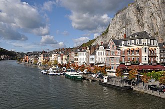
The Rhine–Meuse–Scheldt Delta is a large area where three important rivers—the Rhine, the Meuse, and the Scheldt—come together in the Netherlands. This mixing of waters creates many islands and channels, with rivers changing names as they flow. Even though the Rhine brings most of the water, the whole system is often called the Rhine Delta.
This delta is very important for trade and travel because the rivers act like highways for ships. It connects the North Sea to places deep inside Germany, France, and other parts of Central Europe. Big cities with important ports, like Rotterdam and Antwerp, are located here. The land in this area is protected from flooding by strong walls and barriers called the Dutch Delta Works.
Geography
The Rhine–Meuse–Scheldt Delta is a river delta in the Netherlands. It is formed where the Rhine, Meuse, and Scheldt rivers meet. The shape of this delta changes because the rivers split into many different branches.
The Rhine splits into two main parts near Millingen aan de Rijn: the Waal and the Nederrijn. Near Arnhem, the IJssel branches off from the Nederrijn. This creates three main flows. The largest branch starts as the Waal and changes names many times before reaching the sea. The middle flow begins as the Nederrijn and becomes the Lek. The northern flow keeps the name IJssel until it flows into Lake IJsselmeer.
Over time, the rivers have changed their paths. Big projects like the Delta Works helped control the rivers and protect the land from flooding. Today, the delta has many arms and smaller rivers, and some old river paths are now used to drain water from fields.
History
Already when Julius Caesar lived, the land called the "Island of the Batavi" was known to the Romans. The Rhine River split into two main parts, the Oude Rijn and the Waal. In those days, the Waal flowed into the Meuse River.
The writer Pliny the Elder wrote about tribes living on islands in the area where the Rhine River spread out. He talked about the big island of the Batavians and the Cananefates. He also mentioned many other groups living along a stretch of land near where the Meuse River met the sea.
Emissaries
There are five important waterways, called emissaries, in this area. They are:
- Haringvlietdam (a dam that blocks the Haringvliet)
- Nieuwe Waterweg (a canal linking Rotterdam to the North Sea)
- North Sea Canal, connecting Amsterdam to IJmuiden
- Afsluitdijk, a dam that closed off the Zuiderzee, with special gates at Den Oever and Kornwerderzand for letting water out.
Images
Related articles


This article is a child-friendly adaptation of the Wikipedia article on Rhine–Meuse–Scheldt Delta, available under CC BY-SA 4.0.
Images from Wikimedia Commons. Tap any image to view credits and license.