Safekipedia

Grand Canyon

Explorer · ages 7 and underAdapted from Wikipedia
The sun sets over the Grand Canyon in Arizona, USA, as seen from Yavapai Point.

What Is the Grand Canyon?

The Grand Canyon is a very deep canyon in Arizona, in the United States. The Colorado River carved it over a very long time. It is 277 miles long, and up to 18 miles wide.

The Grand Canyon is a river valley on the Colorado Plateau. Its rock layers are very old, and people come from all over to enjoy its colorful views.

Caring for the Canyon

The land around the canyon is shared and protected by several areas. These include the Kaibab National Forest, the Hualapai Indian Reservation, the Havasupai Indian Reservation, and the Navajo Nation. President Theodore Roosevelt worked hard to protect the area. He visited it many times.

Scientists still talk about how the canyon was made. The river and its side streams cut through layer after layer of rock. Since about 5 or 6 million years ago, the river has kept cutting the canyon deeper and wider.

People and the Land

For thousands of years, Native American people have lived in this area. They built homes inside the canyon and in its many caves. The Pueblo peoples thought of the Grand Canyon as a special, holy place. They traveled to it on pilgrimages.

Weather and Visitors

The weather changes depending on how high you are. Along the river it can get very hot in summer. On the rims it can get very cold in winter, and snow falls there.

About five million visitors come to the Grand Canyon each year. Most of them come from the United States. People enjoy hiking, running, and seeing the canyon from the air.

Quiz time!

3 questions about Grand Canyon

Question 1 of 3

Which state is the Grand Canyon in?

Pictures

A photo taken from the International Space Station in 2014 shows the Grand Canyon and the land around it, including rivers and canyons carved over millions of years.
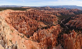
An aerial view of the Grand Canyon, showing its deep, colorful rock layers carved over millions of years by the Colorado River.
A diagram showing the layers of rock in the Grand Canyon, from the oldest rocks at the bottom to the youngest at the top, along with the gaps in time called unconformities.
A rockfall scar and piles of broken rock on the North Rim of the Grand Canyon, where cliff layers of Coconino Sandstone have slowly crumbled away over time.
Ribbon Falls, a waterfall tucked into a grotto on the North Kaibab Trail in Grand Canyon National Park.
Ancient granaries built high above the Colorado River at Nankoweap Creek in the Grand Canyon, made by the Ancestral Puebloan people long ago.
A painting by Augusto Ferrer-Dalmau showing the 1540 Spanish expedition reaching the Colorado River near the Grand Canyon.
Members of John Wesley Powell's second expedition rest at midday in Marble Canyon in 1872, with their boats beside the river.
David Rust (left) and a companion pose with two burros beside a tramway sign on the Tonto Plateau at the Grand Canyon, around 1910.
The Grand Canyon Railway Station and the El Tovar Hotel in Grand Canyon Village, Arizona, photographed in 1994 as part of a historic buildings survey.
Towering cliffs rise above Hermit Camp in Grand Canyon National Park, as shown in an early Fred Harvey postcard.
The Grand Canyon in winter, showing its layered rock walls under snow and cold, clear skies.
Morning fog drifts through the layered rock walls of the Grand Canyon in Arizona.
Grand Canyon Climate Summary Chart (NPS)
A bighorn ram perched on a cliff in the Grand Canyon
A bighorn ewe at the Grand Canyon, 2008
Grand Canyon regional map
Grand Canyon rescue helicopter, 1978

Keep exploring

This article is a child-friendly adaptation of the Wikipedia article on Grand Canyon, available under CC BY-SA 4.0.

Images from Wikimedia Commons. Tap any image to view credits and license.