 Safekipedia
Roman Britain
Adapted from Wikipedia · Explorer experience
Roman Britain
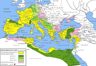
Roman Britain was the part of the island of Great Britain that became a Roman province called Britannia. The Romans came to Britain a long time ago. They first arrived in 55 and 54 BC when Julius Caesar landed there during his time in Gaul. He met the Britons, who had been influenced by a group called the Belgae.
Real Roman rule started in AD 43. The emperor Claudius sent armies to help a king named Verica of the Atrebates. The Romans built towns and roads, changing many things in Britain.
The Romans brought new ways of farming, building cities, and making things. People from many parts of the Roman Empire moved to Britain, creating a special mix of cultures. The Romans built big walls like Hadrian’s Wall to protect their lands.
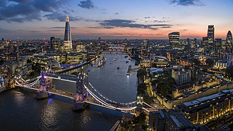
After about 400 years, around AD 410, the Romans left Britain. The land began to change in new ways. Many towns and roads the Romans built are still used today. Cities like London, Manchester, and York started as Roman towns.
The Romans also brought new plants and animals to Britain. They introduced a type of nettle and possibly smaller rabbits. They built systems for clean water and waste to keep cities healthy.
Today, Britain’s main language, English, comes from tribes who arrived after the Romans left. Before that, people spoke a language called Common Brittonic, which later became languages like Welsh and Cornish. Some Latin words from the Romans mixed into these older British languages.
Images
Related articles


This article is a child-friendly adaptation of the Wikipedia article on Roman Britain, available under CC BY-SA 4.0.
Images from Wikimedia Commons. Tap any image to view credits and license.