Safekipedia

Continent

Explorer · ages 7 and underAdapted from Wikipedia
The Blue Marble, a famous photo of Earth taken by the Apollo 17 astronauts on their way to the Moon in 1972.

What Is a Continent?

A continent is a very big piece of land on Earth. Scientists and people around the world sometimes disagree about how many continents there are. This is because they use different convention ideas to decide.

Some continents are one large landmass. Others are part of a bigger piece of land. Asia and Europe are joined together, so they can be counted as one.

The Seven Continents

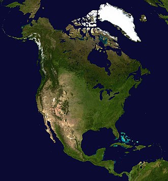
Most English-speaking countries say there are seven continents. From biggest to smallest, they are Asia, Africa, North America, South America, Antarctica, Europe, and Australia. Australia is sometimes called Oceania.

Some people count fewer continents. They join some of them together. North and South America can be called the Americas. Africa, Asia, and Europe can be called Afro-Eurasia.

Some islands are grouped with a nearby continent. Many islands in the Pacific Ocean are grouped with Australia to form Oceania.

Long Ago

Long, long ago, the land was joined together in one huge piece called Pangaea. Over a very long time, it broke apart. The pieces slowly moved apart and became the continents we know today. This idea is called continental drift.

Some continents are not completely separate. Africa and Asia are joined by land, and North and South America are joined too. People built waterways called canals to make ships go between some of these lands.

The five rings of the Olympic flag stand for the five continents where people live. Even small islands like Madagascar and big ones like Greenland are part of the story of our world's land.

Quiz time!

3 questions about Continent

Question 1 of 3

What is a continent?

Pictures

The Waldseemüller map from 1507, the first map to use the name "America" and the first to show the Americas as separate from Asia.
An animated map showing the continents of the world, with the bottom-right continent labeled Australia.
A map of the seven continents, showing Australia as its own continent, separate from the wider region of Oceania.
A map showing how Earth's land was joined together as one giant supercontinent called Pangaea about 200 million years ago.
A satellite view of India, showing its land, mountains, and surrounding areas as seen from space.
A topographic map showing Zealandia, a mostly underwater continent in the southwest Pacific Ocean, with New Zealand and New Caledonia poking above the waves.
An old engraved portrait of Strabo, the ancient Greek geographer who wrote about the lands and peoples of the Mediterranean world.
A medieval 'T and O' map of the known world, drawn by Isidore of Seville and printed in 1472. These maps usually had east at the top, Jerusalem in the center, and were divided into three continents.
A page from an old handwritten copy of the Rigveda, one of the oldest Hindu scriptures, written in Sanskrit using the Devanagari script.
A 1663 map titled "Hollandia Nova" showing the southern lands Dutch explorers discovered in 1644, based on a map by Joan Blaeu.
A view of planet Earth from space, showing blue oceans and swirling white clouds.
The Earth Day flag, designed by John McConnell, shows our planet as seen from space.
Leaves of Aegopodium podagraria, also known as ground elder, photographed against a black background.
Map of island countries: these states are often grouped geographically with a neighboring continental landmass.
Sixteen principal tectonic plates of the continents and the floor of the oceans

Keep exploring

This article is a child-friendly adaptation of the Wikipedia article on Continent, available under CC BY-SA 4.0.

Images from Wikimedia Commons. Tap any image to view credits and license.